Dynamic Laser Scanning
NavVis VLX Versatile Reality Capture
Faster than a terrestrial laser scanner
NavVis is a wearable indoor mobile mapping system that enables
high-quality capture in even the most complex building such as
construction sites, staircases and technical rooms.
All-in-one
Capture 3D measurements with two mulit-layer LiDAR sensors in combination with industry-leading SLAM software to deliver survey-grade point cloud quality. Four cameras positioned on top of the device take high resolution images in every direction for complete 360 capture - all without the operator appearing in the field of view.
Live Mapping
Monitor your scanning progress in real time with a built-in touchscreen interface, to ensure complete coverage as you move.
Ergonomics
A first-of-its-kind wearable device which enables operators to comfortably scan at the speed of walking. The forward-facing design allows for targeted scanning, together with a built-in screen for optimal viewing.
Geo-registration
NavVis VLX is fully compatible with standard tools in the field. It can capture control points in a local site coordinate system measured by Total Stations and GNSS rovers, and also supports national and global coordinates for precise geo-registration and alignment of datasets.
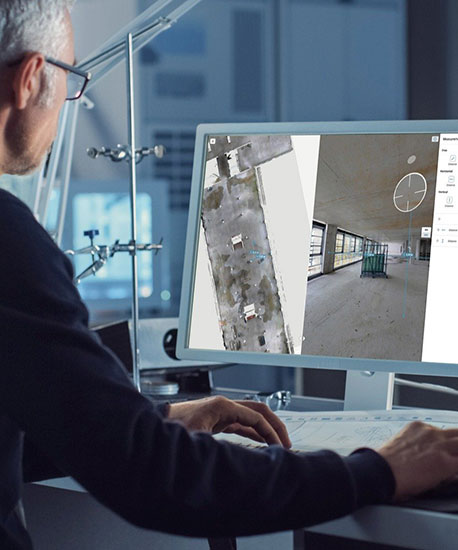
NavVis Reality
Capture Solutions
Optimize and Extend Scanning Workflows
- BIM software
- CAD software
Use NavVis mobile mapping systems to optimize
existing scanning workflows with a faster, more
efficient way to capture high-quality point clouds
for BIM and CAD application. Or extend existing
workflows by using the point clouds and 360°
images with NavVis IVION 3D visualization
software to deliver realistic, fully immersive
digital twins.
Why mobile mapping is a better way to scan
Speed
Mobile systems are the fastest
way to capture built environments
Scalability
Yake on more projects of greater scale
by capturing large projects in less time
Minimal Disruption
Even large projects can be captured
within short windows of downtime
Reliability
With huge improvements every
generation, mobile mapping technology
has been embraced and praised by
professional surveyors all over the world
Frequency
Scan on a regular basis to make
sure building documentation is
always up-to-date
Accuracy
Within the mobile mapping category,
NavVis VLX exceeds the requirements
of your clients and projects - and data
quality that compares favorably with
a terrestrial laser scanner